Forecaz and Toowoomba Regional Council show how AI turns urban growth into infrastructure reality at PIA Qld Conference
- Team Forecaz
- Sep 1, 2025
- 4 min read
Updated: Mar 1
KEY TAKEAWAYS:
The Forecaz platform transformed the Toowoomba Region Growth Plan into a detailed, spatially sequenced urban growth model powered by AI, revealing that only 43% of designated expansion areas are likely to develop over the next 30 years. This provided council with a realistic, evidence-based foundation for infrastructure planning and Residential Activation Fund (RAF) submissions.
Scenario modelling capabilities in the Forecaz platform allowed TRC to test Gentle Density infill strategies and pressure-test structure plans before any policy work was undertaken, identifying zoning placements that would fail to deliver the intended density outcomes and enabling planners to refine their approach with spatial evidence.
Mahmudul (Mac) Haque, Senior Infrastructure Planner at Toowoomba Regional Council, joined Forecaz CEO Bradley Rasmussen on stage at the PIA Queensland Conference 2025 to present a detailed case study on how AI-powered urban growth modelling is transforming planning policy into spatially sequenced, infrastructure-aligned forecasts for the Toowoomba region.
Showcased at the Empire Theatre
The presentation took place at the beautifully restored Empire Theatre in Toowoomba, as part of a session that also featured City of Gold Coast and other practitioners applying AI to urban planning challenges. The Forecaz and Toowoomba Regional Council (TRC) presentation drew on work completed to support the Toowoomba Region Growth Plan (TRGP), adopted by council in March 2023.
Growth Projections for the Toowoomba Region
The TRGP was developed to inform a new Planning Scheme and Infrastructure Plan for the region, responding to significant forecast growth occurring in the region. Within the Toowoomba Urban Extent (TUE), population is projected to grow 42% from 144,000 in 2021 to 204,800 by 2051. Dwellings are forecast to grow 41% over the same period, from 58,500 to 82,800.
Building an AI‑Powered Urban Growth Model
To support this planning work, TRC engaged Forecaz's Forecaz platform to build an AI-powered urban growth model. The platform takes multiple inputs including council planning schemes, GIS layers, development approvals, and existing land use data, then applies spatial analysis and AI to produce a sequenced forecast of where, when, and at what density development will occur across the region.
Bayesian Network Modelling Framework
At the centre of the model is a Bayesian Network (BN) model that formalises urban planner expertise into a structured, weighted framework. Factors such as lot size, site coverage, frontage, zoning, proximity to services, and infrastructure access are each classified and weighted to produce a Development Desirability Index for every property. This index drives development propensity, which the model then uses to sequence growth across five-year projection periods out to 2051.
Findings on Expansion Area Take‑Up
One of the most significant findings from the modelling concerned the take-up of expansion areas identified in the TRGP. The growth strategy for the TUE directed development to expansion areas in the first 15 to 25 years, before transitioning to consolidation of inner core areas. The model showed that only 43% of the designated expansion areas would be consumed within 30 years, giving council a data-grounded view of realistic land supply against population targets.
Infrastructure Capacity and Development Sequencing
The model was also configured to align development sequencing with water and sewer network capacity. In the Darling Heights and Drayton area, the model showed clearly that some land inside the Priority Infrastructure Area (PIA) would not develop without a future sewer pump station. The model demonstrated spatially where that infrastructure investment would activate growth, providing a direct and defensible case for Residential Activation Fund (RAF) applications.
Industrial and Commercial Land Supply Insights
For non-residential growth, the model confirmed that industrial expansion areas designated in the TRGP would not be taken up by 2051 under current conditions, with ample ultimate development capacity available within existing zones. This finding gave planners confidence that the long-term commercial and industrial land supply position was sound.
The presentation also covered two scenario modelling exercises.
Scenario 1: Gentle Density Infill Opportunities
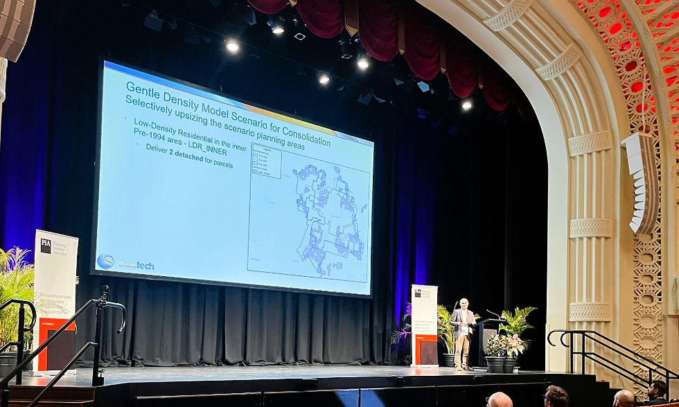
The first tested a Gentle Density scenario for inner consolidation areas. Using historical aerial imagery to identify pre-1946, pre-1971, and pre-1994 development eras, Forecaz created scenario planning zones that applied selectively higher zoning densities to older housing areas. The BN model then identified suitable parcels based on low site coverage, street frontage above 18 metres, corner and multi-frontage lots, and developable area thresholds. The model showed these density settings would support 15 to 20 years of infill supply, with limited development opportunities at the 2046 projection year.
Scenario 2: Higher Density Around Kearneys Spring
The second tested a higher density scenario around the Kearneys Spring major centre. A hand-drawn structure plan from a planning workshop was converted into geospatial planning zones and assigned zoning densities ranging from Low-Medium Density Residential at 100 dwellings per hectare through to Mixed Use at 160 dwellings per hectare. Running the model revealed a practical problem: the Low-Medium Density zoning in parts of the structure plan would deliver no development by 2051. The model showed where the zone needed to be repositioned to the east of the centre to achieve its intended density outcomes. This demonstrated how modelling can be used spatially test policy changes before any zoning is formalised.
Model Validation and Delivery to TRC
Model outputs were delivered to infrastructure network planners at TRC in April 2024, with network planning proceeding over the following 10 to 12 months. On-the-ground validation of model-predicted dwellings against actual dwellings delivered by Development Applications confirmed the model is performing well, particularly in assessing the land supply capacity of greenfield sites.
The session was hosted by Nicholas Kamols and also featured Andrew Saad from City of Gold Coast presenting dashboards and 3D Digital Twin frameworks built on top of the Forecaz-powered PUG model, and Matt Abbasi showcasing AI-based identification of secondary dwellings from spatial imagery.
This conference session reinforced that the intersection of AI, planning, and infrastructure is not a futuristic concept. It is here today, driving measurable value for local governments and their communities.
Bradley’s post on LinkedIn.